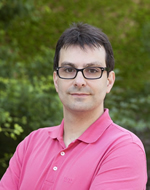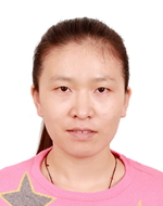
ESR1: Guiying Du
guiying dot du at uni-muenster dot deGuiying Du had a job as Database Engineer in NavInfo co, Ltd, Beijing(China).She got her master degree in Geographical Information System from Wuhan University (China) in 06.2012.
Research topic: Public displays as integrators of open cities

ESR16: Adeoluwa Akande
adeoluwa dot akande at isegi dot unl dot ptAdeoluwa has a Bachelor of Technology degree in Meteorology from the Federal University of Technology, Akure, Nigeria and holds a Joint Master of Science degree in Geospatial Technologies from three universities in Europe. Professionally, he has worked on many foreign funded development projects providing data driven technology solutions. This include the GEMS3 project in Nigeria funded by the UK-DFID as a GIS Software Developer and the highresolution mapping of human settlement project in the Democratic Republic of Congo funded by Bill and Melinda Gates Foundation as a Senior GIS analyst with eHealth Africa.
Research topic: Sustainable Smart Cities assessment framework
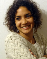
ESR3: Ana Maria Bustamante
bustamante at uni-muenster dot deArchitect (Universidad de los Andes - Colombia) and master graduated from the Erasmus Mundus Program in City Regeneration (Ecole Supérieure d’Architecture de Paris-La Villette). Since 2006, she had been part of academic and non-governmental projects related to poverty reduction, social exclusion, population resettlement, community empowerment, social architecture and urban and regional planning.
Research topic: Using and adapting open citizen data for different user groups
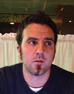
ESR4: Albert Acedo
d2015455 at novaims dot unl dot ptAlbert Acedo Sánchez studied Geomatic and Surveying Engineering at Polytechnic University of Catalonia. He worked as surveyor for six years. He finished his Master in Territorial Planning and Environmental Management at University of Barcelona in 2013, where he had the opportunity of being involved in some research projects related with hybridity in the public space. Then he took the Erasmus Mundus MSc. in Geospatial Technologies, focusing in the interaction between technology, space and citizens from a participatory point of view.
Research topic: Volunteered geographic information, integration in public participation and geographic information systems
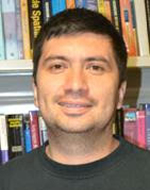
ESR5: Mijail Naranjo
d2015456 at novaims dot unl dot ptHe holds a Master degree in Geospatial Technologies, achieved in 2014; and Engineering in Computer Science and Information, achieved in 2005 at National Polytechnic School in Quito-Ecuador. During 2006-2007 he made a course in Remote Sensing and GIS at CRECTEALC-INAOE in Puebla-Mexico. About his working experience: from 2014 to 2015 as a Head of Software Solutions Department at the City Hall in Quito-Ecuador; from 2009 to 2012 as Java-Oracle developer at the Internal Revenue Service in Quito-Ecuador; from 2007 to 2009 as a .Net-Oracle developer at the Inter-American Development Bank in Washington DC; from 2004 to 2006 as a Java-Oracle programmer at the Social Security Institute in Ecuador.
Research topic: Determinants of ICT for online citizen participation in city/urban contexts: implications of 2nd order digital divide

ESR6: Khoi Manh Ngo
mngo at uji dot esNgo Manh Khoi is currently a Ph.D candidate and researcher at Institute of New Imaging Technologies (INIT), Universitat Jaume I. He holds a Master degree from the Erasmus Mundus Joint Master Degree (EMJMD) PERCCOM. His research interests include communication network, eHealth, Smart Cities and mobile crowdsourcing. He has published one paper in the HealthCom 2015 Conference.
Research topic: Participatory sensing framework
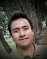
ESR7: Diego Pajarito
pajarito at uji dot esDiego Pajarito is interested in Mobile Computing, Big Data Analytics, high performance spatial analysis, and its near-people applications. He was assistant teacher on GIS, Spatial Databases and Software Engineering at Bogotá’s District University “Francisco José de Caldas” for five years. Also worked as a consultant for different government agencies of Colombia like Ministries (Agriculture, Justice), Environmental Agencies and Planning Offices.
Research topic: Mobile services for green living
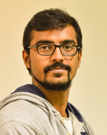
ESR8: Shivam Gupta
Shivam dot gupta at uni-muenster dot deMaster Graduate in Geo-informatics from Symbiosis International University. His research interest include Health GIS, Quality of life, Spatio-temporal analysis of Environmental risk & Exposure analysis, Geo-medicine and IOT for GI. In the past few years he worked with various Geospatial companies like ESRI and Hexagon Geospatial on projects related to Cloud of GIS, SDI creation and Public safety. He has also worked on several projects and papers related to Health, Environment and GIS for Quality living.
Research topic: Sensing quality of life

ESR9: Marek Smid
D2015454 at isegi dot unl dot ptMarek holds Master degree in Applied Ecology (Czech University of Life science) and also in Geographical Information Management (Cranfield University). He started his career as a geomatics analyst in Geomatics Group (UK Environmental Agency) and later at the Joint Research Centre of European Commission (JRC-EC), where he had the opportunity to participate on phenological time-series-analysis, and software and product development. His scientific interests includes GIS, urban planning, geo-statistics, spatio-temporal analysis and the application of abovementioned in the environmental context.
Research topic: Climate change and impacts on the quality of life in urban systems

ESR10: Luis Santa
d2015459 at novaims dot unl dot ptFernando Santa was assistant professor at Universidad Distrital Francisco José de Caldas and Universidad Nacional de Colombia in Bogotá, he taught Econometrics, Introduction to the Statistical Simulation, Spatial Statistics, Geostatistics, Probability and, Statistics. He has had the opportunity of being involved in some research projects developing statistical models mainly in Spatial and Spatio-Temporal modeling. He holds a MSc in Geomatics and two BSc in Statistics and Cadastral and Geodetic Engineering. He has published papers in several academic journals and conferences.
Research topic: Predictive analytics - human mobility patterns investigation from social networks

ESR11: Manuel Fernando Benítez
benitezm at uji dot esHe is Cadastral and Geodetic Engineer at Francisco José de Caldas District University in Bogota – Colombia, He was coordinator of a team of innovation in Colombia and Developer Program Manager in Esri Colombia creating geographic applications, His main interest are GIS, development of native/web applications and spatial analysis.
Research topic: Multi-scale, multidimensional urban information integration, matching and visualization
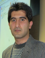
ESR12: Mohammad Mehdi Moradi
moradi at uji dot esMohammad Mehdi Moradi received his bachelor degree in Statistics from Shahid Chamran University, Ahvaz, IRAN in July 2011. After graduation from bachelor degree, he started his studies in master program in the field of Mathematical Statistics at Shahid Beheshti University, Tehran, IRAN and got his master degree in September 2013 in which his main research was about spatial point processes, especially summary statistics. His research interests include spatio-temporal point processes and spatial statistics.
Research topic: Spatio-Temporal Online Social Network Analysis

ESR13: Mehrnaz Ataei
m dot ataei at uni-muenster dot deMultidisciplinary background in Human Computer Interaction (master- Umeå University - Sweden) and Computer Engineering (bachelor - Kashan University - Iran). She had been working as Interaction designer and UX designer in different projects since 2013.
Research topic: Proximity-based opportunistic information sharing and privacy protection
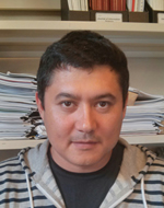
ESR14: Rustam Kamberov
d2015457 at novaims dot unl dot ptRustam Kamberov’s expertise includes 14+ years of experience as a GIS Specialist and 5 years as a Java EE/Python developer. He has an engineering degree in IT, and an MSc in Geospatial Technologies through an international joint degree program. His interdisciplinary research interests include developing web-enabled decision support solutions and mobile computing. Over the last two years, he has also been working on self-initiated IT projects that contribute to the general public in an effort to positively impact their lives.
Research topic: Use of social paradigms in smart cities mobile context-aware computing

ESR15: Manuel Portela
portela at uji dot esManuel Portela is an Interactive Designer and Researcher at GEO-C PhD Programme, interested in fields related to SmartCities and HCI. He coursed a Msc on Urban Studies at Universidad Nacional General Sarmiento in Argentina. He have been researching in the Instituto Superior de Urbanismo at the Universidad de Buenos Aires. And, over the last years, he worked at Gobierno de la Ciudad de Buenos Aires as an advisor in SmartCities and digitalization. He also developed several projects oriented to civic engagement and participation in Latin América.
Research topic: Situational awareness as a service
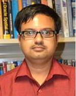
Dev Bhattacharya
dbhattacharya at novaims.unl dot pt Personal siteSensor web integration and spatial data infrastructures

Sergi Trilles
strilles at uji dot esgeospatial information, interoperability, sensor networks and internet of things
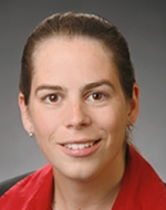
Angela Schwering
schwering at uni-muenster dot despatial cognition, qualitative spatial reasoning and cognitive navigation

Carlos Granell
carlos dot granell at uji dot esMulti-disciplinary GIS, model web, and spatial analysis & visualization
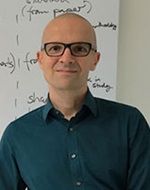
Christian Kray
c dot kray at uni-muenster dot degeoinformatics, mobile and ubiquitous computing, human-computer interaction, and location-based services
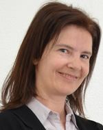
Cristina Costa
ccosta at novaims dot unl dot ptgeostatistical modelling of spatial-temporal phenomena

Edzer Pebesma
edzer dot pebesma at uni-muenster dot de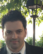
Francisco Ramos
francisco.ramos at uji dot es3D computer graphics, interactive systems, visualization and GIS

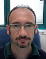
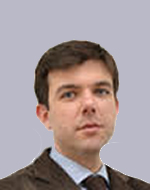
Roberto Henriques
roberto at novaims dot unl dot ptgeospatial data analysis and decision support systems using articial intelligence and data mining methods

Sven Casteleyn
sven dot casteleyn at uji dot esweb engineering, semantic web, mobile computing and context-aware systems
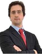
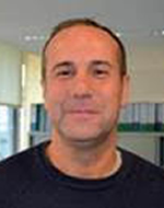
Vitor Santos
vsantos at novaims dot unl dot ptinformation systems architectures, planning and management; artificial intelligence & information systems; information systems for smart cities and informatics for people
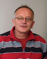
Christoph Brox
broxc at uni-muenster dot deGeneral information about the doctoral program and program coordinator at ifgi

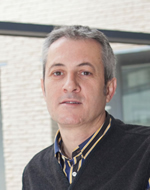
Christian Kray
c dot kray at uni-muenster dot deGeneral information about GEO-C research program and scientific coordinator at ifgi

Warning: simplexml_load_string(): Entity: line 1: parser error : Space required after the Public Identifier in /users/apache/geo-c.uji.es/htdocs/right_contentRSS.php on line 17
Warning: simplexml_load_string(): <!DOCTYPE HTML PUBLIC "-//IETF//DTD HTML 2.0//EN"> in /users/apache/geo-c.uji.es/htdocs/right_contentRSS.php on line 17
Warning: simplexml_load_string(): ^ in /users/apache/geo-c.uji.es/htdocs/right_contentRSS.php on line 17
Warning: simplexml_load_string(): Entity: line 1: parser error : SystemLiteral " or ' expected in /users/apache/geo-c.uji.es/htdocs/right_contentRSS.php on line 17
Warning: simplexml_load_string(): <!DOCTYPE HTML PUBLIC "-//IETF//DTD HTML 2.0//EN"> in /users/apache/geo-c.uji.es/htdocs/right_contentRSS.php on line 17
Warning: simplexml_load_string(): ^ in /users/apache/geo-c.uji.es/htdocs/right_contentRSS.php on line 17
Warning: simplexml_load_string(): Entity: line 1: parser error : SYSTEM or PUBLIC, the URI is missing in /users/apache/geo-c.uji.es/htdocs/right_contentRSS.php on line 17
Warning: simplexml_load_string(): <!DOCTYPE HTML PUBLIC "-//IETF//DTD HTML 2.0//EN"> in /users/apache/geo-c.uji.es/htdocs/right_contentRSS.php on line 17
Warning: simplexml_load_string(): ^ in /users/apache/geo-c.uji.es/htdocs/right_contentRSS.php on line 17
Recent Posts
Acknowledgement
GEO-C is funded by the European Commission within the Marie Skłodowska-Curie Actions, International Training Networks (ITN), European Joint Doctorates (EJD). The funding period is January 1, 2015 - December 31, 2018, Grant Agreement number 642332 — GEO-C — H2020-MSCA-ITN-2014.
